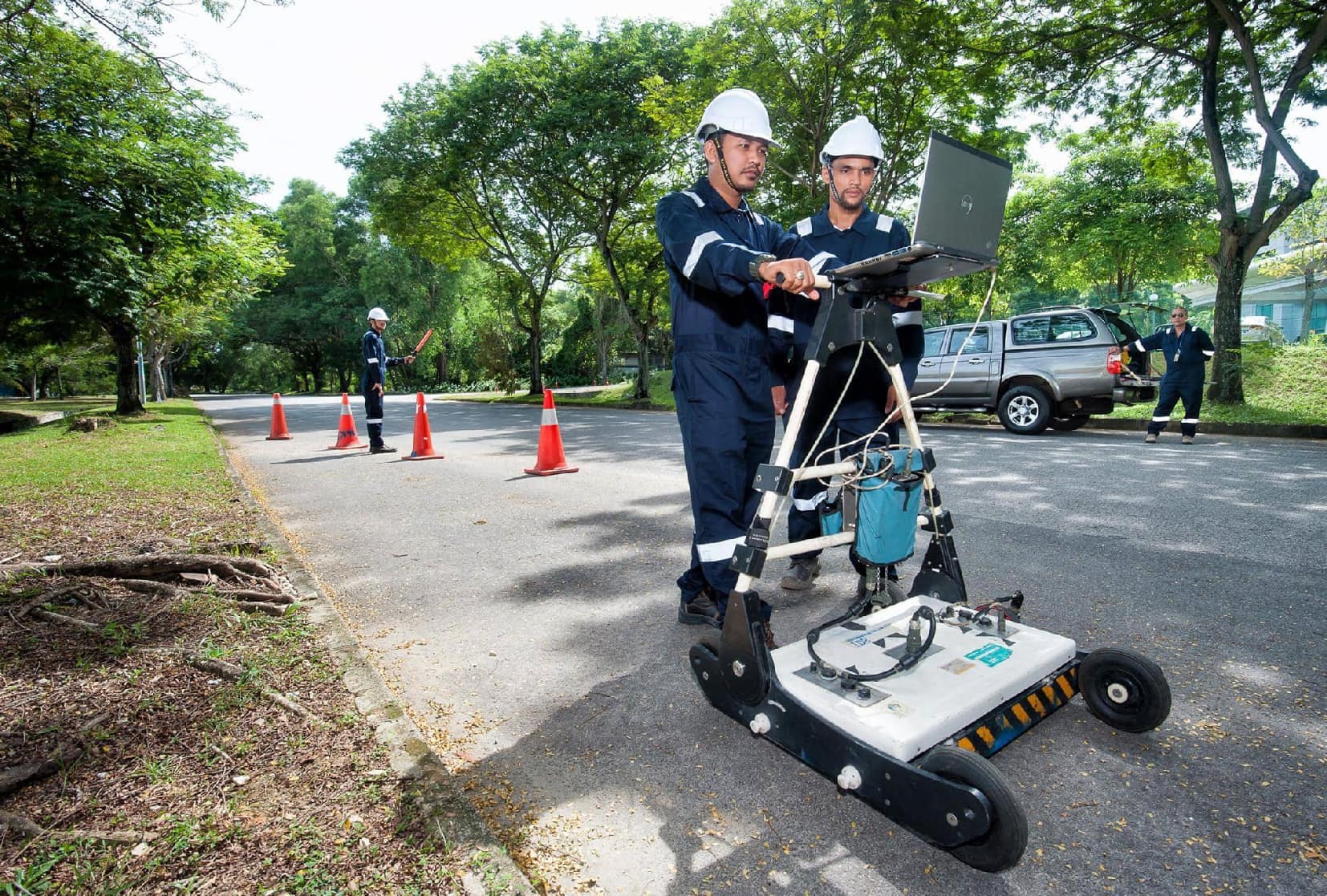
Non-invasive (or ‘no-dig’) locating of buried services and other objects using a combination of electromagnetic detection and the ground penetrating radar systems.
Underground Utility Mapping
JP Surveys offers Underground Utility Mapping services to accurately detect, trace, and map buried infrastructure such as electrical cables, water pipelines, gas lines, and drainage systems. By utilizing a combination of Ground Penetrating Radar (GPR) and Electromagnetic Locators (EML), we deliver reliable subsurface data essential for safe and efficient project execution.
This service helps clients prevent costly damages, minimise construction risks, improve site planning accuracy, and ensure compliance with safety standards during excavation, development, and infrastructure upgrades.
Key Features & Benefits
Non-Destructive Detection
Locates underground utilities without digging or damaging existing structures.
Accurate Mapping Output
Delivers detailed plans showing the position and depth of subsurface utilities.
Supports Safe Excavation
Minimizes risks of utility strikes and enhances on-site safety compliance.
Integrates with Survey Data
Utility maps can be overlaid on topographic surveys and site plans.
Reduces Project Delays
Avoids unexpected service interruptions or rework due to unidentified underground utilities.
Our Solutions
Detailed Scope of Work
1.Non-invasive (or ‘no-dig’) locating of buried services and other objects using a combination of electromagnetic detection and the ground penetrating radar systems.
2.The use of sophisticated proprietary data acquisition and post-processing software allows for the determination of buried routes or positions of :
Power cables
Telecommunication lines
Metallic and non-metallic pipes
Buried objects (such as underground storage tanks)
Areas of application shall include, but not limited to :
Urban planning
Risk management for utility service providers
Detailed route planning
Deliverables
Hardcopy plans
Digital data in Autocad format
Cadastral overlays, radar scan files and tomographic maps may be offered as optional items
Project Gallery
Need a Tailored Solution? Get in Touch With Us
We deliver solutions that align with your specific project requirements. Our team provides expert support and clear direction, ensuring you get the results you need—efficiently, accurately, and professionally.